Google Daydream Internship
EarthVR // Daydream Labs
Official Mentors: Rob Jagnow, Stefan Welker
unofficially, the whole Earth VR and Daydream Labs teams
During this internship I was given the incredible opportunity to learn and worth with two amazing teams in Google Daydream - EarthVR and Daydream Labs. EarthVR was focused on the development of their product and deploying it to different devices/introducing new features. Daydream Labs was a team focused on rapid prototyping of compelling VR/AR experiences. My internship allowed me to sit between both.
I was given access to the EarthVR Unity API allowing me to generate 3D geometry from Google Earth’s data and use it for VR/AR experiences. During my time with Google I built several prototype experiences.
PaintEarthVR
Technologies used: Unity, EarthVR Unity API, Blocks Unity API (later Poly, now discontinued), Firebase API for storage
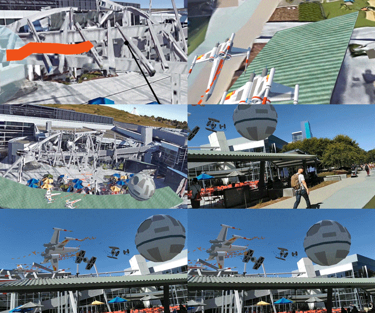
Paint / load models in Earth VR --> view them in real life via AR
For this project, I explored what it would mean to paint on Earth in VR. I built a full VR application that allowed users to fly across earth and paint or place 3d models where they pleased. These paintings were then saved with their geographical coordinates so they could be viewed later.
I then explored how this could be further used in AR. I built an AR app that loaded these paintings/models and displayed them in the approximate geographic coordinates they were placed in real life.
In the gif, I demonstrate painting and loading 3D starwars models in the sky above Google Mountainview HQ. Then, I go to this location in *real life* and can view these VR-arranged models through an AR compatible phone.
Earth AR
Technologies used: Unity, EarthVR Unity API, Android AR compatible phone
Mount Shasta displayed as a 3D model in AR on a tabletop

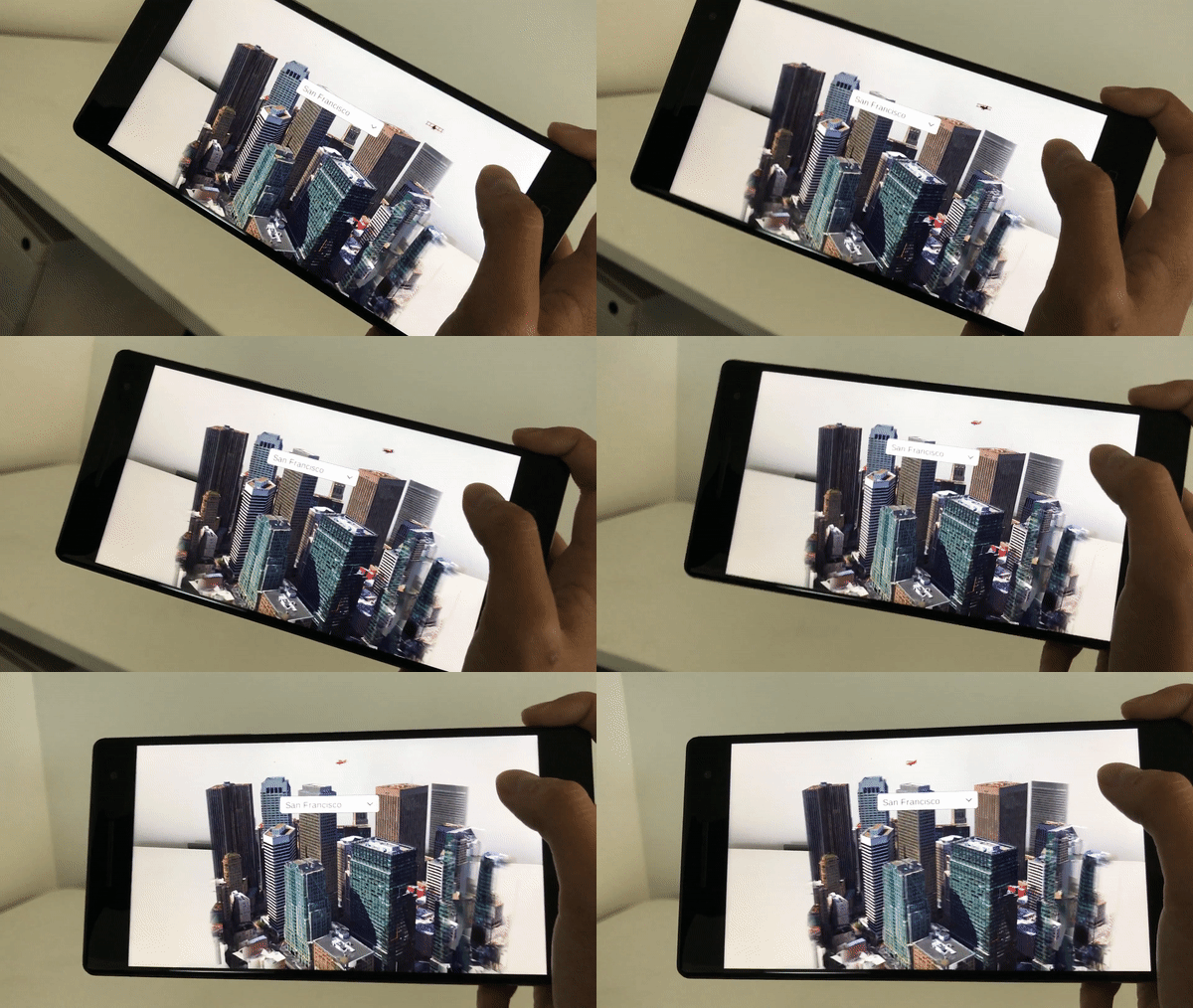
A cartoonish 3D model airplane flying around 3D downtown SF in AR.
The next project I explored was bringing EarthVR geometry to AR. In other words, bringing the magic of EarthVR to our tabletops.
I built an AR app that allowed you to plop major landmarks onto real surfaces and explore the land around them in 3D (by scrolling through the phone, dragging new land into view).
We also explored incorporating 3D models as seen by a small plane hovering around downtown San Francisco in the gif.
I built an AR app that allowed you to plop major landmarks onto real surfaces and explore the land around them in 3D (by scrolling through the phone, dragging new land into view).
We also explored incorporating 3D models as seen by a small plane hovering around downtown San Francisco in the gif.
Google Maps in AR
Technologies used: Unity, EarthVR Unity API, Android AR compatible phone, Google Maps Nav API
Google Maps directions for traveling in London (you can see the London Eye and Big Ben).
The last project I completed with Google was exploring how Google Maps Navigation could be used with Earth AR. I prototyped a simple starting location to destination app that displayed your route in 3D.
In the image, you’ll see a route for traveling in London. In this case, the user would benefit from the 3D view showing large landmarks such as the London Eye and Big Ben.
In the image, you’ll see a route for traveling in London. In this case, the user would benefit from the 3D view showing large landmarks such as the London Eye and Big Ben.
